
Key points
- Geological mapping is essential for understanding Earth and other planetary bodies, supporting decisions in resource management, hazard assessment and environmental planning.
- Mapping extreme environments like remote deserts, polar regions, ocean floors, and planetary surfaces relies on advanced remote sensing technologies and techniques.
- Ensuring the accuracy and usefulness of geological maps requires multidisciplinary collaboration, rigorous review and investment in education and training for future mappers.
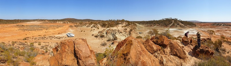
From Australia's remote deserts to the surface of Mars, geological mapping underpins how we understand landscapes, natural resources and the processes that shape our planet and others beyond it.
A recent Nature Geoscience paper published by researchers from Australia, Europe and the United States explains geological maps sit behind some of the biggest decisions we make: from where we build and what we protect, to where we look for the minerals for modern life.
Mapping a dynamic planet
In Australia, geological mapping supports groundwater discovery in arid regions, informs assessments of bushfire, flood and landslide risk, and guides mineral exploration across vast terrains such as the Pilbara, Yilgarn and Gawler Craton in Western Australia.
In practice, modern Australian mapping is increasingly a blend of fieldwork and big‑picture sensing using satellites, airborne sensors and marine surveys. Together, they reveal features hidden beneath vegetation, soil, ancient sedimentary cover and even the ocean, expanding our view of the continent from deep crust to seabed.
Today, scientists are collecting more geological data than ever before.
But if that information sits in disconnected systems, or uses different terms for the same features, it's harder to turn into the clear, consistent maps that communities, governments and industry rely on.
Creating maps that are accurate, consistent and useful is far from straightforward, particularly in extreme environments where traditional fieldwork is difficult or impossible.
When maps don't quite meet
For decades, geologists have mapped large areas by breaking them into smaller sections, known as map sheets. While practical, this approach can introduce inconsistencies. Different teams often interpret rock units and geological boundaries in slightly different ways, meaning map sheets don't always line up neatly at their edges.
This challenge doesn't stop at state or national borders. Even in Australia, geological styles and terminology can shift from one jurisdiction to the next. Internationally, the problem becomes even more complex, as countries use different standards, datasets and mapping conventions.
CSIRO Senior Principal Research Scientist Dr Jens Klump explained how these inconsistencies impact interpretation.
"These breaks in understanding make it much harder to see the big picture," said Dr Klump.
"Yet geological processes don't stop at borders — whether they're between states, countries or continents."
Many of the same processes that shape Earth, such as volcanism, celestial impacts, faulting and erosion, also shape the Moon, Mars and other rocky worlds. That's why geological maps are a core tool in planetary science.
By mapping remnants of lakes and rivers on Mars or impact craters on the Moon, scientists can reconstruct a planet's history and assess where resources such as water ice might occur, providing critical information for future exploration.
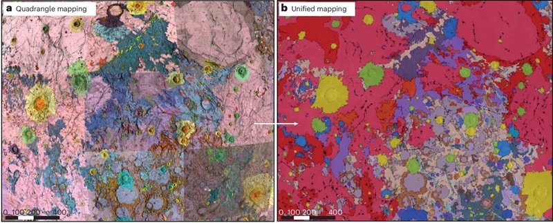
Two images (a and b) showing side by side comparison of same area of lunar geological map.
Figure 1a (on left): A historic, hand‑drawn geological map of the Moon created in the 1960s. The surface is divided into distinct regions mapped by different cartographers, each area showing variations in terrain using contrasting colours and labels. The patchwork appearance reflects how separate teams mapped different lunar quadrangles independently.
Figure 1b (on right): A modern, unified geological map of the Moon produced in 2020. It combines the earlier individual maps into a single, cohesive representation. The surface appears more consistent in style and classification, with harmonised colours and boundaries that provide a seamless, global view of lunar geology.
Extreme environments demand new approaches
Mapping becomes even more challenging in extreme or inaccessible environments. Polar regions, deep oceans, vast deserts and rugged mountain ranges can be dangerous, expensive or simply impossible for people to work in for extended periods.
Instead, geoscientists increasingly rely on a suite of advanced sensing technologies, including satellites, drones and geophysical sensors, to observe and interpret geology from afar. These tools generate large volumes of digital data, often collected at different scales and resolutions.
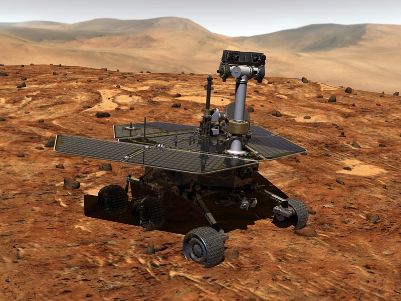
The same challenges apply when scientists turn their attention beyond Earth. Geological mapping of the Moon or Mars must bring together data from orbiters, rovers and remote sensing instruments, with no opportunity to simply walk out and check in the field.
Planning for planets and learning for Earth
Dr Klump is part of an international research effort to introduce shared standards and harmonised concepts that can avoid many of the problems that emerged during decades of Earth-based mapping.
Importantly, the lessons don't only flow one way.
"Working under the tight constraints of planetary exploration makes you think very carefully about what information really matters," said Dr Klump.
"If we design mapping programs to be consistent from the start, we can build better models on Mars and bring those lessons back to improve mapping on Earth."
Understanding geological processes is central to this approach. Rather than seeing a map solely as a static product, scientists increasingly view mapping as a way of capturing how landscapes and rock bodies evolved over time.
Collaboration is key
Creating robust geological maps at continental or planetary scale requires close collaboration across disciplines and organisations. Geologists, geophysicists, data scientists and remote‑sensing experts all contribute different pieces of the puzzle.
It also depends on agreeing how data are collected, described and shared. Standardised digital datasets make it easier to combine information from multiple sources, whether those sources are drones surveying a remote desert or instruments orbiting another planet.
Just as important is investing in education and training. Future geological mappers need skills that span traditional geological knowledge and modern digital tools, ensuring new maps remain accurate, interpretable and useful for decades to come.
Why unified maps matters now
As climate pressures grow, demand for critical minerals increases and space exploration accelerates, the need for reliable, connected geological maps has never been clearer.
From the ocean floor to outer space, scientists are laying the groundwork for more unified, reliable maps that work across borders, environments and even planets.
Whether the goal is finding mineral resources, understanding natural hazards or exploring other worlds, better geological mapping supports better decisions.
"Geological maps don't just describe where rocks are. They capture the processes that shape planets and the knowledge we need to manage them wisely," said Dr Klump.
Recommendations for improving geological mapping was recently published in Nature Geoscience (2026) Geological mapping from the ocean floor to outer space


