
NASA/JPL-Caltech/SwRI/USGS
- Science
- Photojournal
- Mapping Io's Hidden Heat…
Description
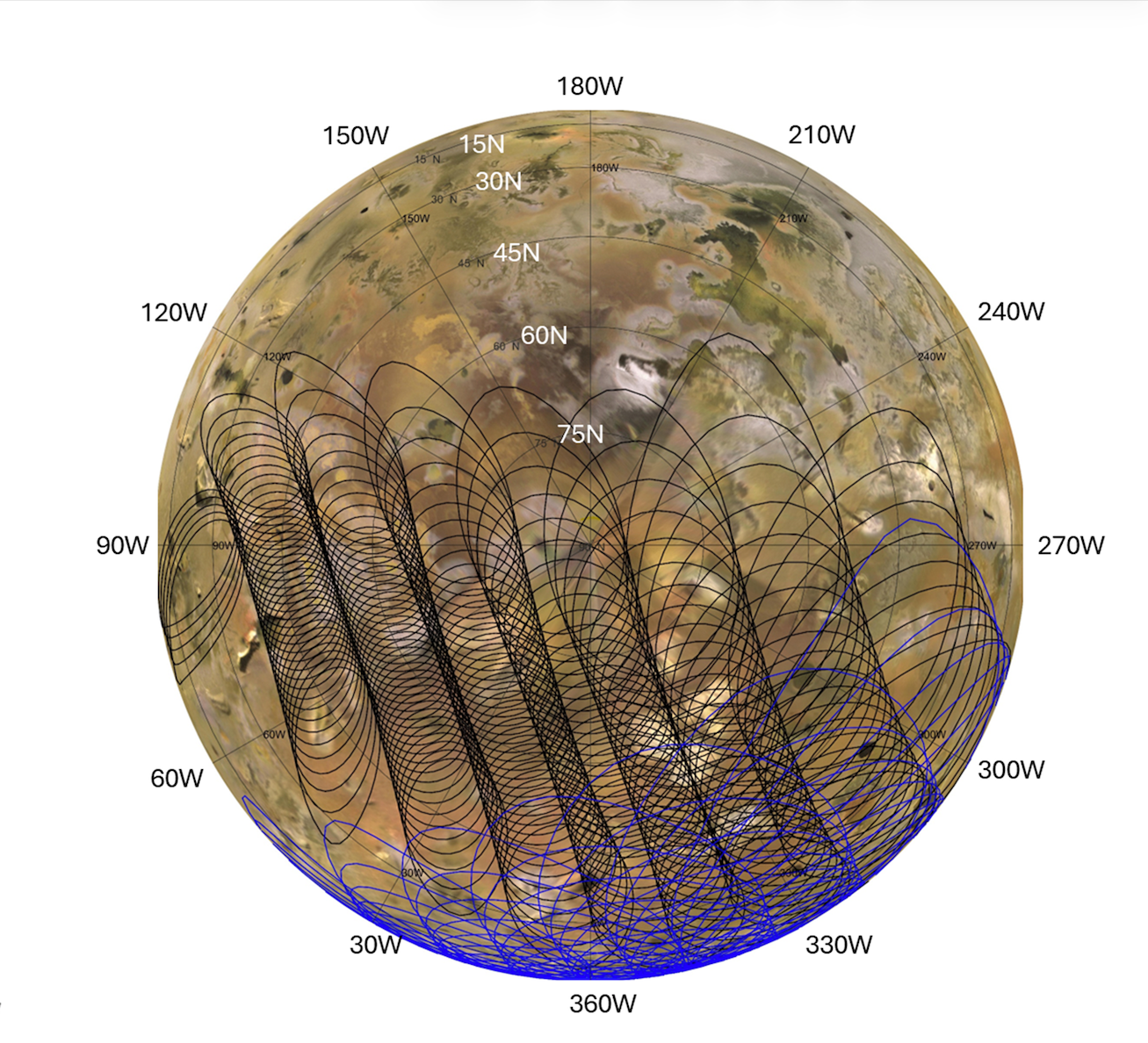
This graphic illustrates the areas of Jupiter's moon Io sampled by the Microwave Radiometer (MWR) instrument aboard NASA's Juno spacecraft during two close flybys. The black overlapping lines show the instrument's footprints during Perijove 57 on Dec. 30, 2023, when the spacecraft primarily mapped the northern hemisphere. The blue lines represent Perijove 58 on Feb. 3, 2024, which focused heavily on the moon's mid-latitudes and equatorial regions.
Both passes mapped the side of Io that constantly faces Jupiter. The sweeping, overlapping patterns are a result of the spacecraft spinning at two revolutions per minute as it flew past the moon at a distance of roughly 930 miles (1,500 kilometers).
NASA's Jet Propulsion Laboratory, a division of Caltech in Pasadena, California, manages the Juno mission for the principal investigator, Scott Bolton, of the Southwest Research Institute in San Antonio. Juno is part of NASA's New Frontiers Program, which is managed at NASA's Marshall Space Flight Center in Huntsville, Alabama, for the agency's Science Mission Directorate in Washington. The MWR was built by JPL. Lockheed Martin Space in Denver built and operates the spacecraft.


