5 min read
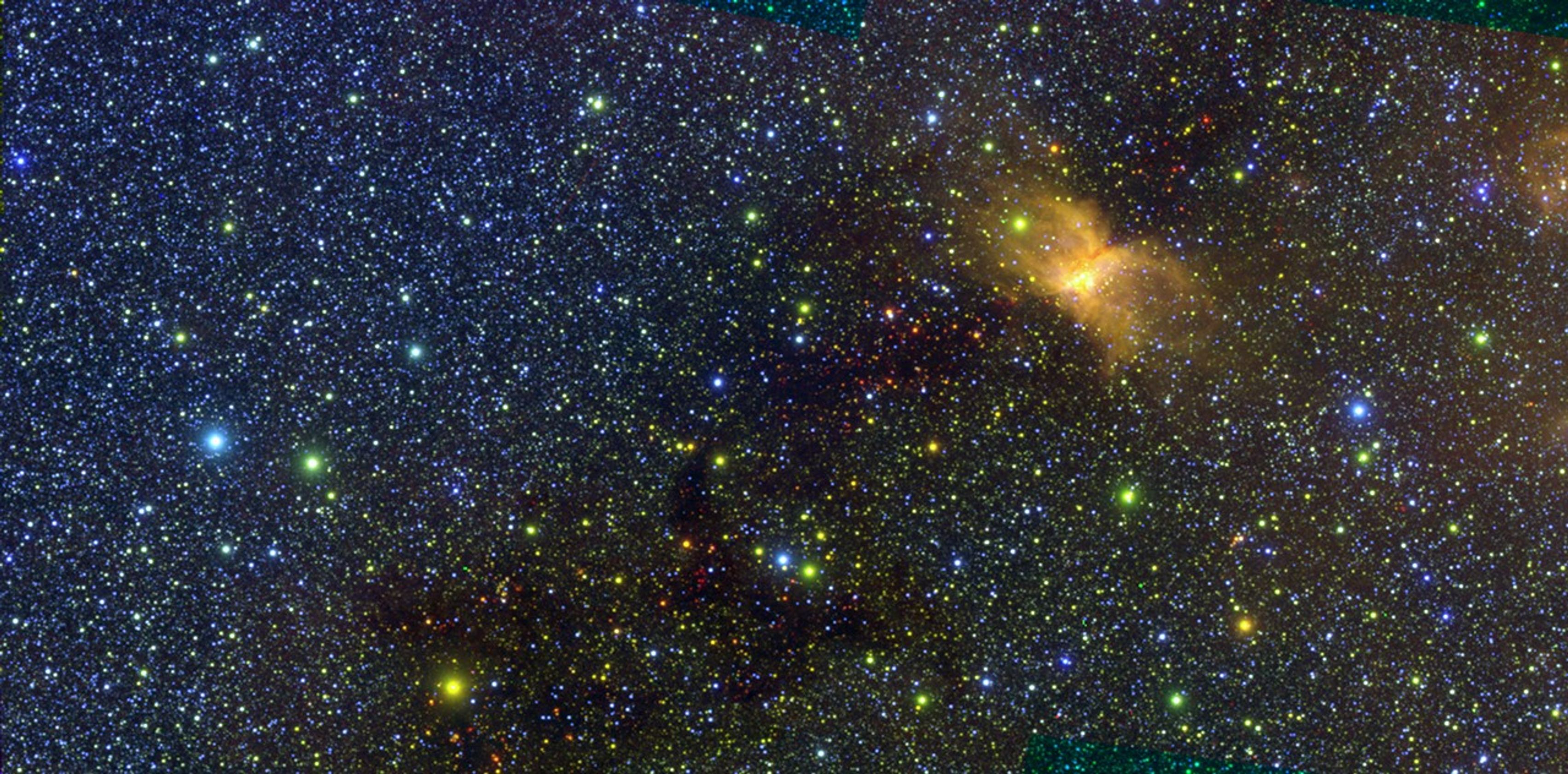
NASA's SPHEREx mission will map the entire sky in 102 different wavelengths, or colors, of infrared light. This image of the Vela Molecular Ridge was captured by SPHEREx and is part of the mission's first ever public data release. The yellow patch on the right side of the image is a cloud of interstellar gas and dust that glows in some infrared colors due to radiation from nearby stars.
NASA/JPL-Caltech
NASA's newest astrophysics space telescope launched in March on a mission to create an all-sky map of the universe. Now settled into low-Earth orbit, SPHEREx (Spectro-Photometer for the History of the Universe, Epoch of Reionization, and Ices Explorer) has begun delivering its sky survey data to a public archive on a weekly basis, allowing anyone to use the data to probe the secrets of the cosmos.
"Because we're looking at everything in the whole sky, almost every area of astronomy can be addressed by SPHEREx data," said Rachel Akeson, the lead for the SPHEREx Science Data Center at IPAC. IPAC is a science and data center for astrophysics and planetary science at Caltech in Pasadena, California.
/Public Release. This material from the originating organization/author(s) might be of the point-in-time nature, and edited for clarity, style and length. Mirage.News does not take institutional positions or sides, and all views, positions, and conclusions expressed herein are solely those of the author(s).View in full here.


