Field data and modeling provide insights into predicting what impacts vital mountain headwaters
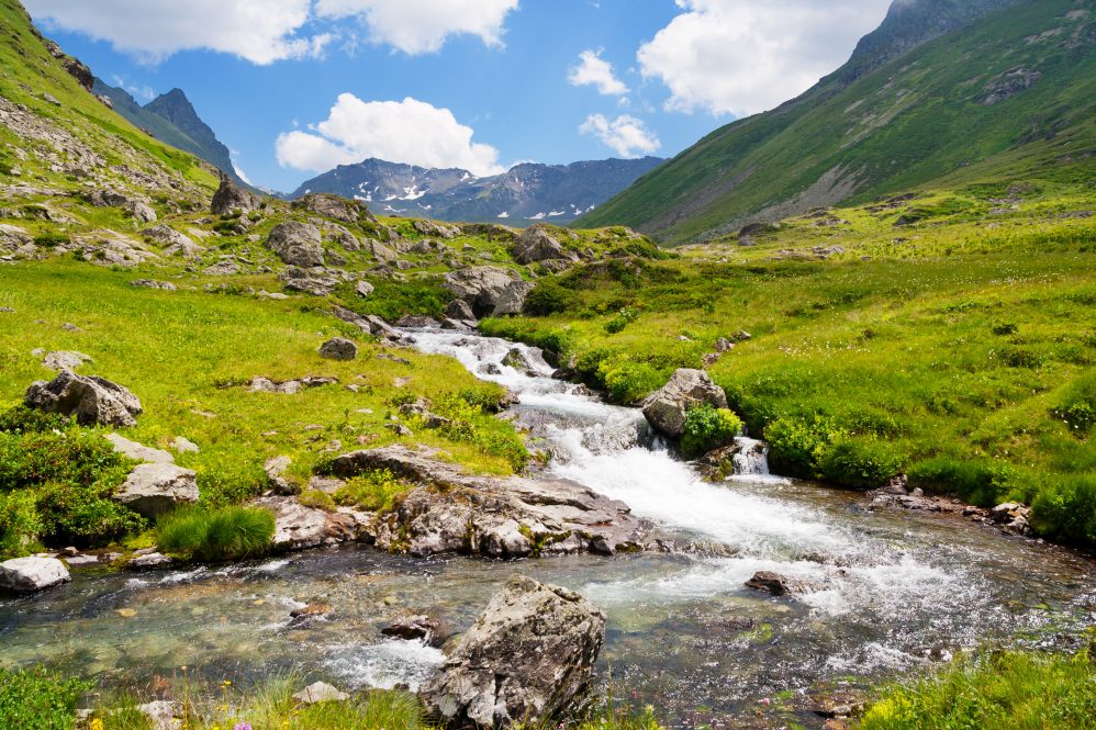
Since millions rely on watersheds, predicting water dynamics will become increasingly important as the climate changes. (Adobe photo)
In mountain regions like the Rockies, headwater streams make up more than 70% of the river network and support the downstream waterways and communities. These headwaters are also home to many forms of aquatic life. While these sources are crucial, very few are monitored, and aspects of their hydrology are not well understood. A team of researchers, including UConn Department of Earth Sciences assistant professor Lijing Wang, are working to determine what influences how and when water moves through these streams, and what hidden source sustains them long after the rush of snowmelt. Their findings are published in Water Resources Research.
The peak rush of water feeding into the headwater comes from snowmelt. In places throughout the Western United States, like the Colorado location at the focus for this study, summertime precipitation is largely lost to the air through evaporation and taken up by vegetation. The question then is, where is the water feeding the streams coming from after the snowmelt period?
"We know it is coming from the hidden source, the subsurface," says Wang. "But how is that subsurface water stored and released? What properties are important for sustaining late season water in headwater streams?"
Without these key details on snowmelt timing and subsurface contribution, it is challenging to predict when and how much water ecosystems and communities downstream can expect. Since millions rely on these watersheds, predicting water dynamics will become increasingly important as the climate changes.
The researchers focused on two potential factors, including the vegetation above ground that may influence snowmelt timing, and different below ground subsurface structures that may influence how snowmelt stores and releases to the headwater stream. Though these mountain watersheds are generally not monitored, Wang says they had the luxury of working with a large data set collected by team members from the Watershed Function Science Focus Area led by Lawrence Berkeley National Laboratory for this paper.
They paired this large data set with a powerful modeling framework allowing the researchers to explore many different combinations to determine which factors are most important, says Wang, and they were able to adjust the model to replicate outcomes that matched the observed data, including streamflow, groundwater levels and snow depths.
"We have unique snow depth measurements using probes with multiple temperature sensors stacked vertically at 18 sites across our catchment," Wang says. "Because snow is a good insulator, the changes in vertically resolved temperature datasets can be used to trace snow depth and understand snowmelt timing."
From the snow depth data, the researchers found the snow melted one to two weeks later in areas where there are evergreens compared to those dominated by shrub, grass, or deciduous forests, even at the same elevation. From their model, they found that these evergreens gradually release snowpack water to streams, acting like a buffer for excessive flow from snowmelt and maintain moderate streamflow over a long period. There are important implications with this finding, says Wang, for instance if these forests are clear cut it could have a serious impact on the area's hydrologic dynamics.
Moving towards the period after snowmelt, they noticed an intriguing pattern in their groundwater level data.
"We saw not only one peak in the groundwater table where the snowmelt gives the largest recharge to the groundwater and it will create a peak," Wang explains. "Later in the season, we saw a very interesting second peak in our monitored wells."
Wang explains they tweaked the model, such as porosity, permeability, and subsurface structures, to understand the subsurface conditions that might give rise to the mysterious second peak.
"This brought us closer to understanding this site. We have granodiorite on the top, and then the Mancos shale below on this hillslope," says Wang. "There is a transition from the upper hillslope to the lower hillslope and the transition delays the water. It is like a bathtub on the upper hillslope, snowmelt fills it, once it builds too much pressure and overflows, the transition can no longer hold water. The second peak is the result of the water that spills out."
Then what is the subsurface control on streamflow? Wang explains she thinks that permeability – how easily water can move through the ground – is an important factor for how stored subsurface water is released to the stream.
"Even if the water is stored there, it's not going to go anywhere if your permeability is very, very low. The downstream streamflow later in the season will be very low if the upstream contribution from subsurface is blocked by this low permeability," says Wang.
Essentially, the shift from the rush of snowmelt to the trickle that remains later in the season depends on how snowmelt releases water which is influenced by vegetation, how it is stored underground afterward, and how subsurface water is eventually released back to the stream.
With these new insights into how streamflow is fed through groundwater storage and snowmelt, hydrologists can better calibrate models for the right reasons. With the abundance of data available and a flexible modeling framework at this site, Wang says the team is gaining a clearer understanding of how water is stored subsurface and released to headwater streams. This knowledge can help reduce uncertainty in predicting water availability in these critical systems and better understand how declining streamflow and rising water temperatures may affect ecosystems.
Wang's ongoing work includes efforts to improve the model so it can be applied to other places that are not as intensely monitored by exploring different types of proxy data that could be used where field data is not available. Wang is also exploring AI to reduce the computation cost of studying these crucial headwaters so that we can better understand hydrologic processes in more headwater catchments.
"It is a tremendous effort to put all of this together," says Wang. "As a modeler, I'm grateful to have collaborators who make this kind of data possible. We have so many headwater streams across the U.S., it's not possible for us to go into every single location and do this comprehensive, intensive monitoring. We need new ways to move forward and make better predictions of these critical water sources."


