With the release of iOS 15, Apple Maps gets its biggest update ever with a city experience that offers rich details, driving routes with better navigation, immersive walking directions shown in augmented reality, and much more. The update, which expands on the new map that Apple spent years building from the ground up, is now available in London, Los Angeles, New York City, and the San Francisco Bay Area, with more cities to come.
"We are thrilled to offer the new Apple Maps experience. Maps is the best way to navigate the world: It is easy to use, beautifully designed, and built with privacy at its core. With this update, we are pushing Maps even further, providing more ways for users to discover the natural beauty of the world and explore cities through a new 3D view," said Eddy Cue, Apple's senior vice president of Services. "Our goal has always been to build the best and most accurate map in the world. The upgrades in Apple Maps are a continuation of that effort, with features and an attention to detail that only Apple can deliver."
Explore Cities with Highly Detailed Maps
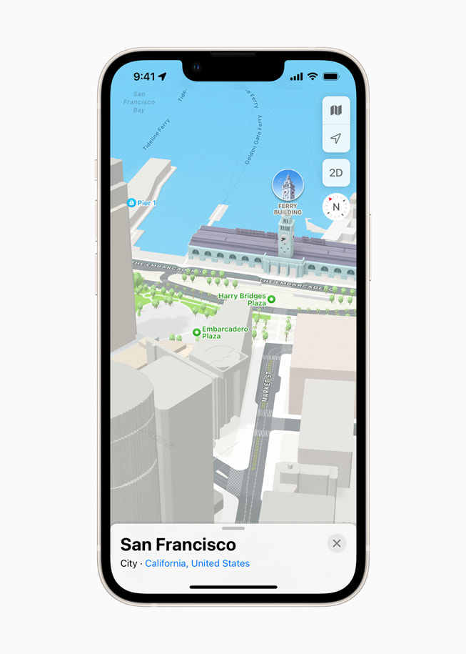
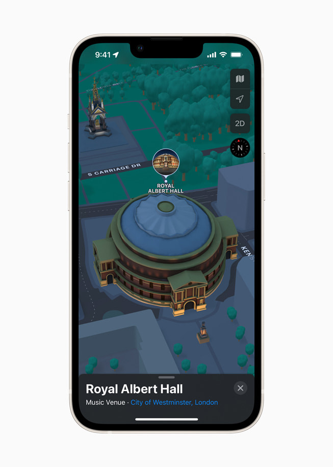
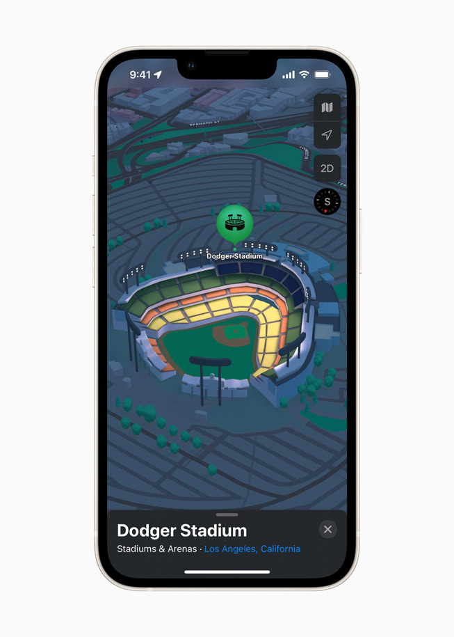
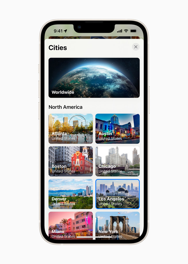
Apple Maps introduces a new way to navigate cities with a visually stunning 3D map that offers unprecedented detail for neighborhoods, commercial districts, marinas, buildings, and more. Now users can see elevation details across a city, new road labels, and hundreds of custom-designed landmarks like Coit Tower in San Francisco, Dodger Stadium in LA, the Statue of Liberty in NYC, and the Royal Albert Hall in London, with more to come. A beautiful nighttime mode with a moonlit glow activates at dusk. The city map experience is now available in London, Los Angeles, New York, and San Francisco, and later this year, it will be available in Philadelphia, San Diego, and Washington, D.C. Support for additional cities, including Montreal, Toronto, and Vancouver, will be available next year.
- iPhone displays a 3D map of San Francisco in Apple Maps in iOS 15.
- iPhone displays a 3D map of Royal Albert Hall in London in Apple Maps in iOS 15.
- iPhone displays a 3D map of Dodger Stadium in Los Angeles in Apple Maps in iOS 15.
- iPhone displays a 3D map of the Statue of Liberty in New York in Apple Maps in iOS 15.

- previous
- next
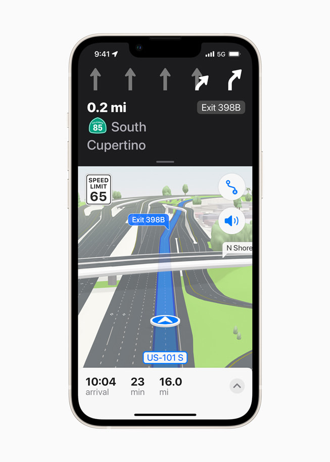
Enhanced Navigation Provides a Better Driving Experience
Maps now features even more road details to help drivers navigate through cities more easily and safely. Turn lanes, medians, bus and taxi lanes, and crosswalks are clearly displayed for navigating busy intersections, and highways with overlapping complex interchanges are rendered in a road-level 3D view, making it easier to see upcoming traffic conditions or the best lane for an approaching exit. Route planning provides the estimated time of arrival for future departures based on expected traffic. The new navigation will be available through CarPlay later this year.
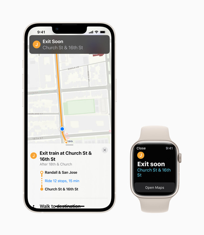
Never Miss a Stop with Powerful Transit Updates
Maps now offers major improvements for public transit riders. Nearby stations are prominently displayed at the top of the screen, and users can pin their favorite lines in Maps so the best route is just one tap away. Once a transit route is selected, Maps will automatically notify a user when it is time to disembark as they approach their final destination, and riders can even keep track on Apple Watch. These updates build on transit features already available in Maps, including real-time transit, which provides detailed transit schedules, live departure times, arrival times, the current location of a bus or train en route, and system connections to help plan a journey. Maps also includes important real-time information like outages.
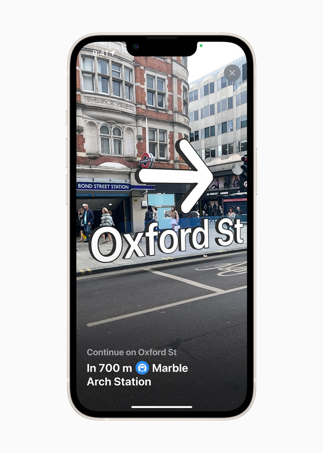
Immersive Walking Directions
With iOS 15, Apple Maps introduces step-by-step walking guidance in augmented reality. Users can simply raise their iPhone to scan buildings in the area, and Maps generates a highly accurate position to deliver detailed directions that can be viewed in the context of the real world.
Discover Great Places with Curated Guides
Maps makes it easy to discover the amazing things to see and do in cities around the world through curated Guides created by a selection of trusted resources. In iOS 15, users can tap the Explore Guides button in Maps to access over a thousand expertly curated guides that include recommendations from respected brands such as Time Out, The Washington Post, the National Park Foundation, Complex, and The Infatuation. Curated Guides can be saved, and they are automatically updated when new places are added, so users always have the latest recommendations. Users can even create their own personal Guides of favorite places to share with friends and family.
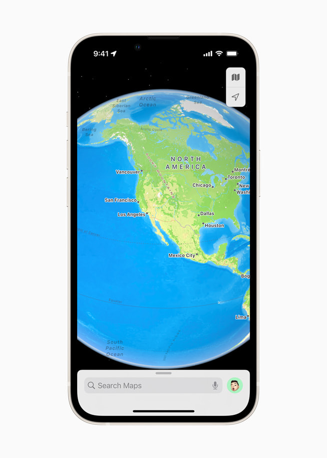
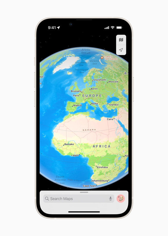
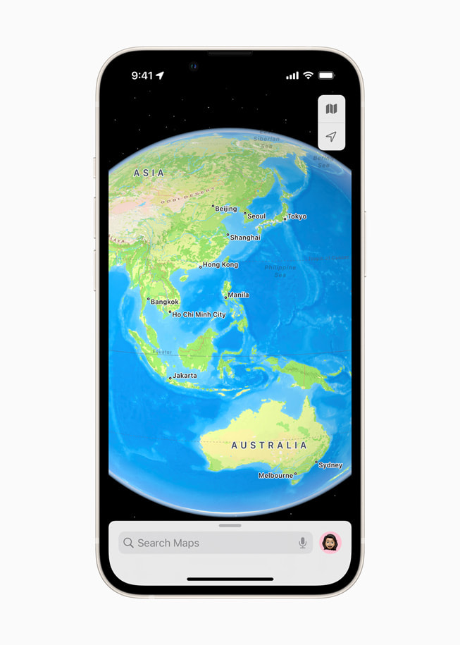
A New Interactive Globe
In iOS 15, Apple Maps offers a rich and interactive three-dimensional globe that introduces a whole new way of looking at the world. The globe shows Earth's natural beauty with amazing textures and contours. Users can see vibrant details of mountain ranges, deserts, rainforests, oceans, and more. Now even the most remote and precious locations on the planet can be explored right from iPhone.
In addition to the new updates available in iOS 15, Apple Maps offers many useful features:
- Look Around gives users a way to explore parts of the world through an interactive 3D street-level experience and a smooth, seamless 360-degree view. Customers anywhere in the world can explore places like Dublin, Edinburgh, London, Los Angeles, New York City, Tokyo, Toronto, and the Italian countryside.
- Cycling directions show the elevation for a ride, how busy a street is, and whether there are stairs along a route. With voice guidance and Haptic Touch on Apple Watch, users can stay even more focused on the path ahead while enjoying their ride.
- Speed cameras let users know when approaching speed and red light cameras along a route, with the added ability to see where cameras are located on the map.


