
Early last month, Utah experienced two historic wildfires at the same time, highlighting the record-setting fire season continuing to unfold in the Beehive State.
While 2026 has not yet surpassed the 2007 record for number of acres burned, this year's fires have so far consumed an unprecedented area of Utah's trees compared to past years. Flames have blackened a record 285,000 acres of woodlands and forest, according to analysis by University of Utah geographers. The lightning-caused Widemouth 2 fire, now raging out of control in Millard County, has scorched about 85,000 acres since July 27.

Utah trending toward bigger, more frequent forest fires
In the face of high temperatures and stubborn drought, Utah is confronting what is shaping up to be its worst fireseason on record, with more than 456,000 acres burned across all land cover types from 752 ignitions, according to Utah Fire Info.
"What's even more important is where this year's fires are burning. They have had unprecedented impacts on Utah's trees," said Phil Dennison, professor in the U's School of School of Environment, Society & Sustainability "This year, Utah has had three fires that have each burned more than 50,000 acres of trees. That's never happened before. To put that number in context, there have been only nine fires since 1986 that have burned more than 50,000 acres of combined woodland and forest."
 The Babylon fire, which burned more than 100,000 acres in San Juan County, drove the state past its previous record for the amount of mid-elevation woodland acreage burned in a single season, according to Dennison's analysis conducted with his colleague Mickey Campbell. And the 97,000-acre Cottonwood fire, that spanned the Tushar Range and destroyed more than 150 structures around Eagle Point Resort east of Beaver, pushed Utah near its record for high-elevation forests burned in a single season.
Fires of this magnitude have become a troubling trend. In Utah, 27% of forest and 20% of woodland burned since 1986 has been in just the last three years, according to Dennison, who directs the Utah Remote Sensing Applications (URSA) Lab. He noted that 10% of Utah's high elevation forest has burned within past 10 years.
"This trend has important economic and ecosystem impacts, and has raised the potential for flash flooding like we saw on the Cottonwood fire last month," he said.
With several weeks still left in the fire season–which has yet to affect northern Utah ranges–wildfires have blackened a record amount of woodland and forest ecosystems, according ton an analysis going back 40 years. Utah woodlands are composed of shorter trees, such as pinyon pines, junipers and Gambel oak. Taller aspen, pines, firs and spruce are the dominant forest tree species. The elevation boundary between the two types of ecosystems is typically around 7,500 feet above sea level in Utah, depending on local climate.
Together, mid-elevation woodlands and high-elevation forests cover 23% of Utah's landcover, with woodlands accounting for two-thirds of the total tree area, or about 8.5 million acres. These tree-covered landscapes are critical to Utah's water supplies and recreation economies and provide irreplaceable habitats for fish and wildlife.

The above graphic illustrates three periods with different levels of fire activity, according to Dennison.
- The period of 1986 to 2021 was characterized by large rangeland fires that burned into woodlands, such as 1989 Diamond Peak fire. Forests rarely burned.
- From 2002 to 2016, a period that coincides with the arrival of the West's "megadrought," Utah began to experience bigger forest and woodland fires. The largest were the 2002 Sanford fire and 2012 Seeley fire.
- The Brian Head fire of 2017 marks the beginning of the current period, marked by massive losses of forest. That fire was Utah's first to exceed 50,000 acres of forest burned. Since then, Utah has seen three years where total forest area burned exceeded 70,000 acres: 2018, 2020 and 2026.
In this grim picture, however, there is a silver lining. In the right place and right size, wildfire offers ecosystem benefits, such as clearing fuels from overgrown forests, Dennison notes. Fire can reinvigorate aspen and Gambel oak, which often quickly resprout following a fire that has temporarily eliminated competition, and lodgepole pines need fire to open cones and release seeds.
These findings are based on ongoing research by Dennison and Campbell, who use remote sensing to study ecosystem disturbance from fire, as well as from insects and drought. Their analysis examined the perimeters of all fires larger than 1,000 acres since 1986, using satellite imagery and various datasets. To determine what vegetation types were burned, they used the U.S. Forest Service's Landscape Change Monitoring System (LCMS), which provides a national satellite map of tree shrub, and grass vegetation types every year going back to 1985.
"We combined the shrub and grass vegetation types together because of their tendency to overlap in Utah, and then split the tree class using a machine-learning model of woodland vs. forest trees based on Forest Service survey data," Dennison said.
Record setting in other ways
The Babylon and Cottonwood fires were also notable for their impacts on the atmosphere in addition to the chaos they caused on Utah's landscapes.
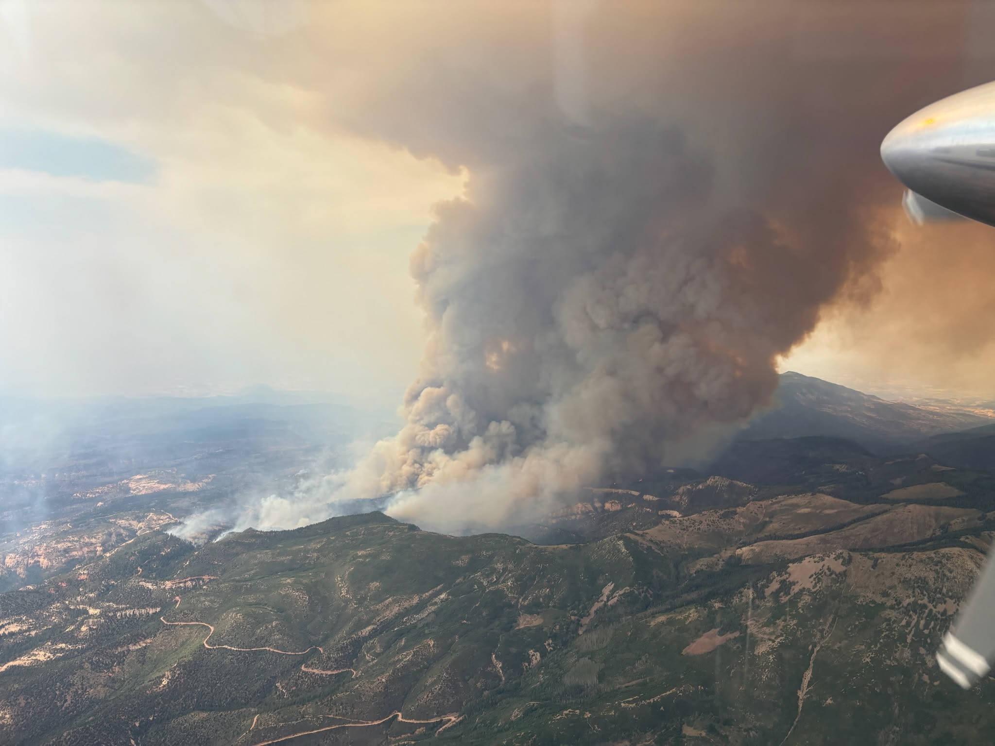
The Babylon fire, for example, unleashed a plume on July 6 that climbed 11.5 kilometers above the ground, penetrating the stratosphere, according to atmospheric scientist Derek Mallia, who taps satellite imagery to study wildfire impacts on the atmosphere. That could be among highest such a cloud, known as a pyrocumulonimbus, or pyroCb, has ever soared above a Utah wildfire. No one can know for sure because a reliable means for measuring these phenomena has only been available since 2018.
Meanwhile, the radiative power emanating from the Cottonwood fire achieved an unprecedented level on June 23, the day following its ignition outside Beaver and quickly grew by 20,000 acres. Mallia calculated its radiative power that day at 180 gigawatts, the highest recorded from a Utah fire.
Such intense fires produce pyroCbs and can generate their own unstable weather, resulting in lightning strikes and high winds that further feed a fire's fury.
Mallia is an expert in forecasting the formation of pyroCbs, which can send smoke particles across a continent. He is currently traveling around western North America, helping guide airborne research teams studying pyroCbs as part of a federally funded field campaign called INSPYRE, an acronym for INjected Smoke and PYRocumulonimbus Experiment, led by NASA.
Banner photo: The Widemouth 2 fire burning in Utah's Pahvant Range on Aug. 3, 2026. Photo credit: Fishlake National Forest. Graphics produced by the University of Utah's URSA Lab using U.S. Forest Service data.


