A team of scientists, including those from the British Antarctic Survey (BAS), have uncovered the hidden remains of a vast ancient coastal plain beneath East Antarctica-an important discovery that could refine forecasts of future global sea level rise.
The international study, led by Durham University and published in the journal Nature Geoscience, used radar data to reveal previously unmapped, remarkably flat surfaces buried beneath a 3,500km stretch of the East Antarctic Ice Sheet, between Princess Elizabeth Land and George V Land.
These surfaces, some of which are believed to have formed over 80 million years ago when East Antarctica and Australia were still joined, are thought to have been smoothed by large rivers before the continent was engulfed by ice around 34 million years ago. Remarkably, these landscapes have remained largely intact, preserved beneath the ice sheet for over 30 million years.

Dr Guy Paxman, lead author and Royal Society University Research Fellow at Durham University, explains:
"The landscape hidden beneath the East Antarctic Ice Sheet is one of the most mysterious not just on Earth, but on any terrestrial planet in the solar system.
"These flat surfaces we've found are likely the remnants of ancient river beds that have survived beneath the ice. Their shape and position now appear to slow down the movement of ice above them, acting almost like a brake on fast-flowing glaciers."
While ice loss from Antarctica is accelerating due to climate change, these ancient fluvial surfaces may be playing a stabilising role – regulating how quickly ice can flow to the ocean through narrow troughs that separate the plateaus.
Co-author Professor Stewart Jamieson, also from Durham, said that factoring these hidden landscapes into computer models could significantly enhance projections of how Antarctica will respond to warming temperatures.
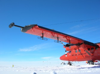
BAS played a key role in collecting and interpreting radar data that helped map the subglacial topography.
Dr Tom Jordan, a BAS geophysicist and co-author, explains:
"These findings show just how much of Antarctica's past remains locked beneath the ice. Understanding the ancient landscapes that influence present-day ice flow is crucial if we're to predict how this huge ice sheet will behave in the future."
The discovery could help scientists improve long-term predictions of sea level rise. If East Antarctica's ice were to melt completely, it holds enough frozen water to raise global sea levels by up to 52 metres. The researchers stress that further exploration is needed to determine how these flat surfaces influenced ice movement in past warm periods. Drilling to obtain rock samples from beneath the ice could confirm when these regions were last ice-free-vital data for improving climate models.
The study was supported by the UK's Natural Environment Research Council (NERC), the Leverhulme Trust, the European Research Council, and international partners including the Alfred Wegener Institute in Germany and the Polar Research Institute of China.
Extensive fluvial surfaces at the East Antarctic margin have modulated ice-sheet evolution, by Paxman, G.J.G, et al, is published in Nature Geoscience, DOI 10.1038/s41561-025-01734-z.


