
Predicting the risk of diseases transmitted by ticks: Researchers in Bavaria are working on this. The University of Würzburg is contributing its expertise in earth observation with high-tech drones.
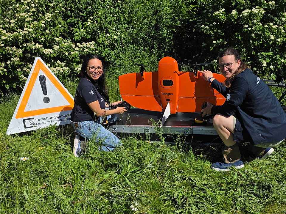
Searching for ticks in the Bavarian region Upper Palatinate: researchers from Würzburg and Munich will meet there in June for fieldwork. The team is also using high-tech drones - but not to track down individual ticks. Instead, they are focussing on the living environment of the small bloodsuckers: Forests and, above all, forest edges.
A remote sensing team from the University of Würzburg will use surveying drones to record thermal, multispectral and LiDAR data. The latter is based on laser technology that allows the vertical and horizontal structure of the forest to be dissected down to the centimetre: Is the edge of the forest open? Or is it more or less overgrown with bushes? Is there only dry foliage on the forest floor? Is it very mossy? Do grasses and other plants thrive there?
This information is intended to clarify the living conditions in which TBE viruses and Borrelia bacteria thrive. These dangerous pathogens are found in ticks and can be transmitted to humans through their bites. The viruses cause meningitis, while the bacteria cause nerve pain, joint inflammation and other symptoms.
Field work at a TBE hotspot
Researchers from Munich collect ticks from the study areas at the same time as the drone flights, if possible. In the laboratory, they then analyse, among other things, whether the animals carry the pathogens.
Why is the study being conducted in the Upper Palatinate of all places? Because the districts of Amberg-Sulzbach and Schwandorf are among the areas with the highest incidence of TBE in Germany. The research team selected around 20 high-risk locations at forest edges for the fieldwork on site: The TBE virus has already been detected at all of them.
"Our high-precision earth observation measurement methods make it possible to initially identify where health risks are lurking on a small scale and in detail and to derive large-scale conclusions from this. Remote sensing with drones in particular provides very precise local data that can then be transferred to larger areas," explains project manager Dr Ariane Droin from the Earth Observation Research Cluster (EORC) at the University of Würzburg.
Goal: Precisely predicting the risk of ticks
Behind the fieldwork is a larger research project with many participants. Its long-term goal is to understand which environmental factors and microhabitat characteristics promote the occurrence of TBE viruses and Borrelia bacteria in ticks.
The analyses are to be used to make predictions as precisely as possible about the times and places in the Upper Palatinate districts where the risk of catching a tick, and thus potentially a dangerous infectious disease, is particularly high. A corresponding small-scale map is expected to be available by mid-2029.
A lot of data is incorporated into the prediction model : climate and weather, reported cases of infection, tick incidence as well as the data obtained with the Würzburg drones and probability predictions. In addition, virological, bacteriological and insectological data is used to map environmental conditions and the spread of TBE and Lyme disease. Finally, machine learning and AI-supported analyses will be used to predict infection risks.
Professor Hannes Taubenböck from the Würzburg EORC: "We want to use earth observation methods to help solve social problems. This project is very concrete and a showcase for the fact that we can only understand complex phenomena such as the spread and existence of TBE viruses or borrelia through interdisciplinary research, in this case through collaboration between remote sensing, virology, immunology, epidemiology, tropical medicine and mathematics."
Who is involved in the project
The project has been running since the beginning of 2026 and is called MONID HABITRACK (Habitat Prediction and Surveillance of Tick-borne Diseases using Modelling and Imaging Technology). It is coordinated by the Data Science Unit headed by Professor Noemi Castelletti at the Institute of Infectious Diseases and Tropical Medicine at LMU Munich Hospital . The project website: https://monid.net/habitrack/
The Earth Observation Research Cluster (EORC) with the JMU Chair of Global Urbanisation and Remote Sensing (Professor Hannes Taubenböck and project manager Dr Ariane Droin) is involved from the University of Würzburg.
The team is complemented by experts from the fields of mathematical modelling, epidemiology, virology and entomology. They come from the German Consiliary Laboratory for TBE (DKF) in Munich, the Fraunhofer Institute for Translational Medicine and Pharmacology ITMP, Immunology, Infection and Pandemic Research IIP, Penzberg/Munich and the Bavarian State Office for Health and Food Safety (LGL) with the National Reference Centre for Borrelia.
1.8 million euros from Berlin
The Federal Ministry of Research, Technology and Space (BMFTR) is funding the project with around 1.8 million euros under the funding code 031L0326A. The project is part of the BMFTR-funded research network MONID (Modelling Network for Major Infectious Diseases).


