2 min read
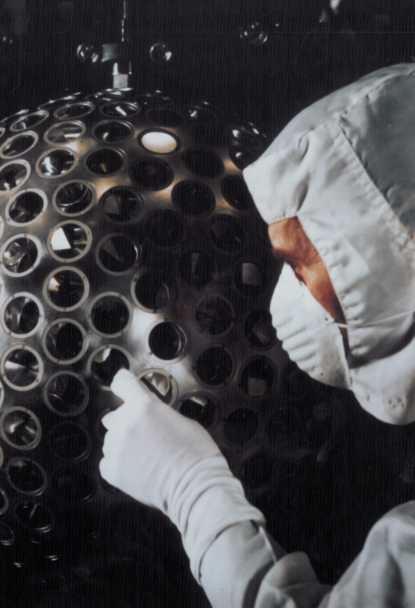
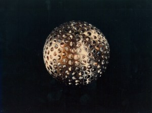
On May 4, 1976, a spacecraft resembling a disco ball entered orbit almost 3,700 miles (6,000 kilometers) above Earth. This shiny, two‑foot‑wide (60‑centimeter) sphere called the Laser Geodynamics Satellite, or LAGEOS, is covered with 426 retroreflectors-small mirrored prisms designed to bounce laser light directly back to where it came from. Beneath its aluminum exterior sits a dense brass core that makes LAGEOS incredibly heavy (900 pounds or 400 kilograms) for its size.
That weight was intentional. The satellite's high mass and compact, spherical design allow it to follow an exceptionally stable orbit, perfect for satellite laser ranging. From stations around the world, scientists fire pulses of laser light at LAGEOS and measure how long the light takes to return. Because the speed of light is known so precisely, researchers can calculate the distance to the satellite within just a few millimeters.

Over these last 50 years, these ultra‑precise measurements have helped track the slow movements of Earth's tectonic plates, monitor tiny shifts in the planet's crust, and measure motion along major fault lines. LAGEOS's data have sharpened our understanding of Earth's shape and refined models of the planet's gravity field. LAGEOS has even contributed to tests of Einstein's theory of general relativity by helping confirm predicted effects on the orbits of massive bodies around Earth.
In 1992, the Italian Space Agency-built LAGEOS II, a near‑twin of the original LAGEOS satellite, was launched aboard space shuttle Columbia. With two satellites to compare, scientists could make even more accurate measurements. Together, they have become long-term benchmarks for Earth science.
Despite being among the oldest scientific satellites still in service, LAGEOS is still going strong. Its simple, maintenance-free design, along with minimal drag in its high orbit, means that it will likely continue to circle the globe for millions of years.