A new review paper led by researchers from the University of St Andrews highlights the transformative potential in the use of radar in polar research to predict future sea levels.
Published in the journal EOS (date) the new research explores how radar has long been used to examine into, and beneath glaciers and ice sheets where direct observations are difficult to obtain. This work focuses on one powerful application – polarimetry – which examines differences in radar signals using different antenna orientations.
Radar polarimetry is primarily used to measure the orientation of ice crystals, known as crystal fabric. This fabric strongly influences how ice flows, a key factor in predicting future sea level rise as ice is transported from land to ocean.
But ice is also a time capsule, preserving a record of past flow and climate changes over thousands to tens of thousands of years. By detecting subtle shifts in crystal alignment, polarimetric radar can reveal when and how ice flow responded to major climate events, unearthing a unique archive of Earth's environmental history.
Dr T.J. Young, one of the lead authors from the School of Geography and Sustainable Development, said: "The methodological and technological advances that we've been seeing in polarimetric radar over the past decade have been so exciting in that it shines a light on to clues that reveal how glaciers have behaved in the past, that were otherwise invisible to other geophysical imaging techniques. By revealing how ice crystals respond to and drive ice flow, we can start to reconstruct past flow patterns and understand how ice sheets have evolved to its present-day form. By capturing this previously neglected process, we can further improve predictions of future ice loss."
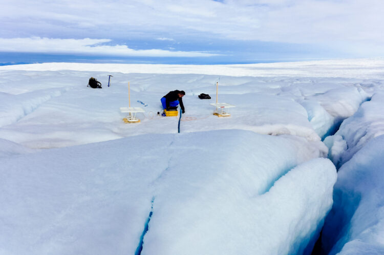
Recent technological innovations, such as the British Antarctic Survey's autonomous phase-sensitive radio echo sounder (ApRES), have rapidly accelerated the application of polarimetry in glaciological research, and further innovation will only expand the use case further. This review paper calls to expand this small but rapidly growing scientific community.
Future developments, including airborne platforms and autonomous rovers, will allow mapping of anisotropic ice properties over entire ice sheets. Such advances will not only refine sea-level projections but also extend to other exoplanets, helping interpret ice dynamics on Mars and icy moons like Europa.


