
The storm still packed quite a punch. It had swept across Florida starting from the state's west coast, and when it reached Fort Lauderdale in the early morning hours of Oct. 24, 2005, its powerful winds damaged the enclosed patio of Cameron Pine's suburban home, where he and his parents were hunkering down.
Had it not been for the heroic efforts of Pine's father, who ventured outside as the storm's tranquil eye passed overhead, their entire house might have been destroyed.
"He put on a Miami Dolphins helmet, got some bungee cord and propped up the patio so that it wouldn't collapse into our kitchen," recalled Pine, who was 5 years old at the time.
That's what Pine, now a Ph.D. student at the University of Miami Rosenstiel School of Marine, Atmospheric and Earth Science, remembers most about Hurricane Wilma, one of four Category 5 storms that made the 2005 Atlantic hurricane season one for the record books.
"Wilma piqued my interest in the phenomena of hurricanes," he said. "I started watching the Weather Channel intently, especially the 50 minutes-past-the-hour tropical weather updates that air during hurricane season, and eventually I even started my own blog on tropical cyclones."
Today, as a doctoral student in the school's Department of Atmospheric Sciences, Pine delves deep into the dynamics of hurricanes, studying how they interact with the environment and how changes in the way they are aligned can cause them to weaken or rapidly intensify.
"Tropical cyclones do not exist in an environment where everything atmospherically is perfect and pristine," Pine said. "There's always vertical wind shear playing a role and affecting hurricanes in some manner."
When it is especially strong, wind shear—the sudden change in wind speed and direction with height in the atmosphere—acts like kryptonite to hurricanes, stifling their formation and weakening existing systems.
"To form and intensify, hurricanes need to be vertically stacked, with the low-pressure center at the surface sitting directly under the upper-level center. Just think of it like being a stack of pancakes," Pine explained. "But wind shear essentially decapitates a storm, pushing the upper portion of a tropical cyclone away from its lower-level center and tilting its vortex. And the larger that misalignment or vortex tilt, the harder it is for a tropical cyclone to intensify."
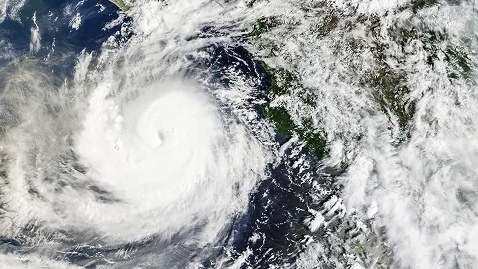
This season, a strong El Niño, a natural climate pattern characterized by warmer-than-average sea surface temperatures in the central and eastern tropical Pacific Ocean, is driving stronger high-altitude westerly winds across the Atlantic basin, increasing shear and suppressing Atlantic hurricanes.
Some storms, however, are able to resist wind shear and achieve vertical alignment, rapidly intensifying as a result. Pine is studying the processes that allow such storms to do that. "Numerical models have struggled in trying to figure that out but only because of the limited observational data we have on these events," he said. "AI models have been impressive, and some have been able to resolve the pathways into which some misaligned tropical cyclones can align themselves. But there is still work that needs to be done."
Essentially a three-dimensional CAT scan of a tropical cyclone, Tail Doppler radar data obtained from Hurricane Hunter aircraft that fly into storms has helped bolster numerical models.
Pine recently deployed on one such reconnaissance mission over this year's hyperactive Pacific Ocean, flying into the heart of Hurricane Rachel to investigate how a disorganized tropical cyclone transitions from a misaligned storm to a vertically stacked system. He also flew as an observational scientist into Hurricane Polo.
"But the planes are not always out there observing and gathering information on storms," he said. So, through his research and under the mentorship of Rosenstiel School scientists David Nolan and Michael Fischer, as well as Cooperative Institute for Marine and Atmospheric Studies scientist George Alvey, Pine is using ground-based radar data and different machine learning methods to fill in the observational gaps.
Learning more about the structure of storms can help save lives and assets, according to Pine. "More and more, we're seeing hurricanes that outperform the numerical models and surprise affected communities by how rapidly they intensify," he said. "It's difficult to forecast vortex alignment in storms, but the better we can get at it, we'll be able to limit the surprise factor of certain hurricanes and give the public ample lead time to prepare for approaching storms."
He is not only helping to ramp up knowledge about the dynamics of hurricanes through his research but also through his outreach. He serves as president of Canes on Canes, a student-led organization that educates the public about the science of hurricanes and hurricane preparedness.
He would like to continue such outreach efforts even after he graduates and moves on to other research endeavors.
"With the rise of artificial intelligence, our understanding of hurricanes is going to improve tenfold over the next few years," Pine said. "But there'll always be a gap in the industry in terms of being able to communicate the science to the public. So there's an opportunity there to not only study hurricanes but to also act as an intermediary, explaining our work in understandable terminology to communities and showing them how what we do benefits society."


