It's time to check your mapping!
The State Government has made changes to vegetation management, protected plants and koala habitat mapping - and AgForce is urging landowners to stay informed.
The new mapping, released on 8 September by the Department of Resources and Department of Environment and Science, covers the following:
- Vegetation Management Act:
- Regulated Vegetation Management v5.0
- Regional Ecosystem v12.0
- Essential Habitat v10
- Wetlands v7.0
- Watercourse 100k v5.0
- Watercourse 25k SEQ v5.0
- Nature Conservation Act:
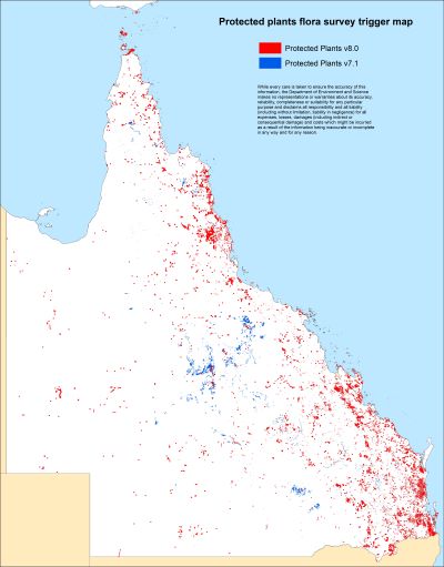
- Protected Plants v8.0
- Koala Habitat Areas v2.0
- Locally Refined Koala Habitat Areas v2.0
Having analysed the new maps, AgForce can report the following changes:
- A decrease in Locally Refined Koala Habitat mapping but a 4% increase in area for the Koala Habitat Area mapping, affects the SEQ area only
- Vegetation mapping, statewide:
- Regulated Vegetation overall has seen little increases in the Cat A, B and C regulated areas.
- Minor decreases in Cat R and X areas.
- Protected Plants, statewide:
- A 16% decrease in the amount of protected plants areas
- A 12% increase in new protected plants area
The protected plants mapping has seen the largest changes. Property owners are urged to check this new mapping as there are some owners who had protected plants mapping under v7.1 but now have zero protected plant areas under the new version.
Unfortunately, there are also examples of some property owners with large increases of protected plants mapping under the new version.
It's important to also note that the changes to the vegetation management mapping do not affect properties with a Property Map of Assessable Vegetation (PMAV).
AgForce will be conducting a meeting with the Department of Environment and Science to gain a better understanding of the large changes to the protected plants mapping.
To assist members in understanding these mapping changes, AgForce will also be creating new GeoPDF maps for each member property. This will include updating AgForce fact sheets pertaining to koala and protected plants mapping, to ensure landowners know where they stand with regard to regulations and compliance.
In preparation for the new maps (coming in the next two weeks) members are reminded to ensure they can sign in to the AgForce website member portal to check their property details. This will also ensure the new maps can be accessed when available.
Members can also request the new maps from the government's website, request a vegetation map or property report (which also includes a map for protected plants). The limitation with this service is it's one request per each Lot on Plan number defining a property.
You can also view new mapping using Queensland Globe.
If you cannot access (sign in) to the member portal or if you have reviewed your new maps and have any questions or issues regarding these changes please contact your Regional Manager.
Rest assured Agforce will continue to strongly press the Queensland Government to ensure that any vegetation management changes are purely evidence-based, are practical and sensible for our members, and do not unfairly disadvantage agricultural producers
In the meantime, we seek to ensure that landowners are properly informed of any mapping changes that may affect their business.


